
Table of contents [Show]
- Decoding the Okavango Delta Map: Landscape Mysteries Revealed
- Tracking Seasonal Transformations on Your Delta Map
- The Evolution of Mapping Africa's Inland Paradise
- Wildlife Mapping: Finding Nature's Hidden Treasures
- Planning Your Dream Safari With Expert Map Navigation
- Protected Zones: Navigating Conservation Boundaries
Decoding the Okavango Delta Map: Landscape Mysteries Revealed
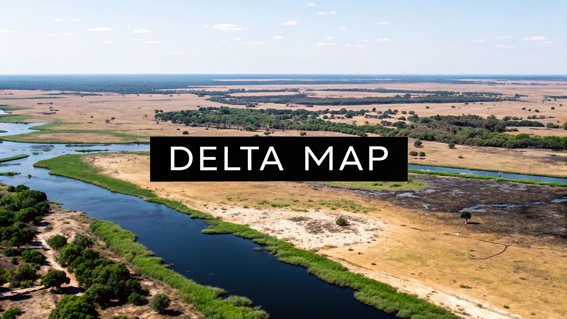
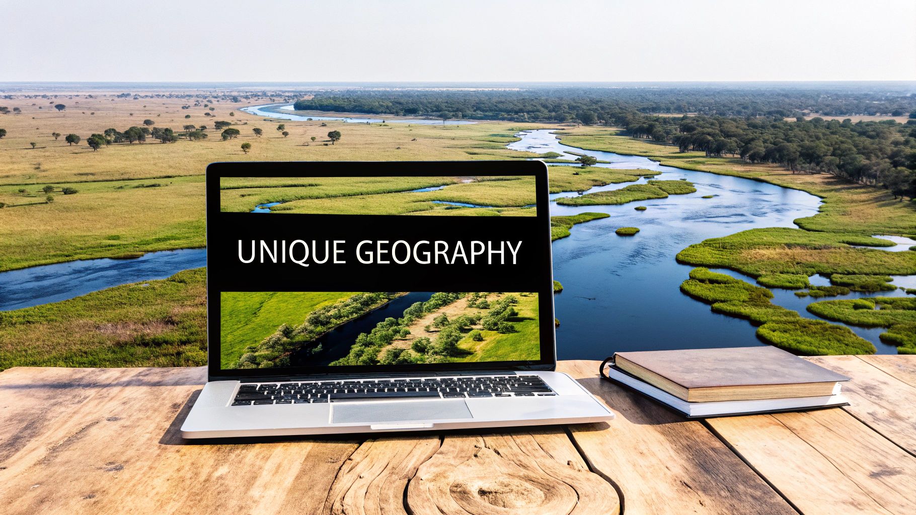
An Okavango Delta map isn't your average wilderness guide. This unique inland delta, a stunning mosaic of permanent swamps, seasonal floodplains, and islands, presents unique challenges to traditional cartography. Truly understanding this ecological marvel requires a deeper dive into its dynamic nature.
Unveiling the Dynamic Landscape
Traditional maps struggle to capture the delta's ever-changing character. The Okavango's water flow isn't constant; it pulses and shifts with seasonal floods, dramatically reshaping the landscape throughout the year. Navigable channels appear and disappear, and islands emerge and submerge, affecting both wildlife movement and human navigation. What might appear as a waterway on a map could be dry land just months later.
The Okavango Delta is famous for its remarkable water system. Roughly 11 cubic kilometers (2.6 cubic miles) of water spread across an area ranging from 6,000 to 15,000 square kilometers (2,300 to 5,800 square miles) annually. It's also an endorheic system, meaning it doesn't flow into the ocean. The water instead disperses into the Kalahari Basin sands, creating a self-contained ecosystem vital to its rich biodiversity. Learn more about the Okavango Delta here: Okavango Delta
Modern Mapping Techniques
This dynamic environment demands a more advanced approach to mapping. Fortunately, advances in satellite imagery and Geographic Information System (GIS) technology are revolutionizing how we navigate and understand this fluid landscape. Geographic Information System (GIS) technology offers real-time monitoring of water flow, allowing for more accurate and up-to-date maps. These tools are essential for both researchers studying the ecosystem and travelers planning safaris.
Using an Okavango Delta map effectively involves understanding key elements. Recognizing landmarks like prominent islands, major water channels, and vegetation types is crucial. It’s also important to be aware of seasonal changes and their impact on water levels. Using a recent map and checking flood prediction reports are key for successful navigation. A good map, combined with current technology, is essential to unlocking the secrets of this unique African wilderness. This knowledge empowers you to fully appreciate the magic of the Okavango Delta, whether for scientific research or an unforgettable safari experience.
Tracking Seasonal Transformations on Your Delta Map
The magic of the Okavango Delta lies in its ever-shifting nature. This constant change affects how we map and navigate this unique wilderness. Flood patterns dramatically reshape the landscape throughout the year, creating a vibrant, dynamic ecosystem found nowhere else on Earth.
Interpreting Seasonal Flood Maps
Understanding an Okavango Delta map means knowing how to interpret seasonal flood predictions. These maps are indispensable tools, especially for seasoned safari-goers. They reveal how channels appear and vanish, islands rise and fall, and wildlife movements shift with the fluctuating water levels. For example, a channel easily navigable in June could be dry land by September, impacting access to different areas. You might be interested in: More on maps and locations. These dramatic transformations influence where wildlife congregate for sustenance, making seasonal maps crucial for planning successful wildlife sightings.
The Power of Real-Time Monitoring
Advancements in remote sensing technology, especially satellite imagery, now allow us to monitor water flow patterns in real-time. This information is incredibly valuable for both conservation efforts and visitor experiences. Conservationists can track the flood’s extent, pinpoint areas of ecological stress, and monitor wildlife populations with greater accuracy.
This real-time data also enhances the safari experience. Guides can navigate more efficiently and anticipate prime wildlife viewing areas based on current water levels, making every safari an unpredictable and unique adventure.
Practical Applications for Your Safari
Seasonal maps extend beyond simple navigation and have numerous practical applications. They're incredibly helpful for planning photographic opportunities, understanding how lodges and camps adapt to changing water levels, and estimating travel times between locations. Some lodges are only accessible by boat during certain seasons, while others might offer walking safaris when the water recedes.
To get the most from your trip, it's essential to understand these seasonal nuances. Choosing the right camp or lodge for your preferred activities will maximize your chances of observing specific wildlife behaviors. For example, during peak floods, some islands become sanctuaries for wildlife, offering exceptional chances to see concentrated animal populations.
The following table summarizes the key features and accessibility changes throughout the seasons in the Okavango Delta:
Seasonal Changes in the Okavango Delta: A comparison of key features and accessibility across different seasons
| Season | Water Coverage (sq km) | Navigable Channels | Best Wildlife Viewing Areas | Recommended Transportation |
|---|---|---|---|---|
| High Water (Apr-Aug) | 10,000 | Extensive network | Moremi Game Reserve, central Delta | Boat, mokoro |
| Medium Water (Sep-Oct) | 8,000-9,000 | Moderate network, some drying | Moremi, Khwai River, Savuti | Boat, mokoro, vehicle |
| Low Water (Nov-Mar) | 5,000-7,000 | Limited channels, concentrated waterholes | Savuti, Linyanti, Chobe National Park | Vehicle, walking safaris |
This table illustrates how water coverage and navigable channels change throughout the year, influencing the best areas for wildlife viewing and the recommended modes of transportation. During high water, boat travel is paramount, while the dry season opens opportunities for walking safaris. Understanding these seasonal variations is essential for planning a rewarding Okavango Delta experience.
The Evolution of Mapping Africa's Inland Paradise
The Okavango Delta map, as we know it today, tells a story. It's a story of exploration, scientific progress, and the integration of generations of local knowledge. From rough sketches to intricate digital models, the evolution of these maps offers a unique perspective on our growing understanding of this ever-changing landscape.
Early Explorations and Indigenous Knowledge
Imagine trying to map a river that's constantly moving. That's the challenge early explorers faced in the Okavango Delta. Its intricate waterways and shifting terrain made accurate mapping nearly impossible. However, the indigenous Bayei and Hambukushu people held the key. Their deep understanding of the delta, passed down through generations, proved invaluable. This local wisdom guided early mapping efforts, helping explorers navigate the complex channels and pinpoint essential landmarks. While the Okavango Delta has been inhabited for at least 100,000 years, it remained largely hidden from the outside world until the 19th century. Learn more about the history of the Okavango Delta. This historical context adds another layer to our appreciation of modern Okavango Delta maps.
The Colonial Era and Aerial Photography
During the colonial era, mapping often focused on economic interests. Resource extraction often took precedence over ecological understanding. Maps from this period frequently highlighted political boundaries and potential trade routes, overlooking the delta's natural wonders. But the mid-20th century brought a significant change: aerial photography. This new technology revolutionized delta mapping. Learn more about Maximum Adventure Trails news. For the first time, the true scale and intricate details of the Okavango Delta could be seen and appreciated.
Modern Mapping: Satellites and GIS
Today, mapping the Okavango Delta relies on sophisticated technologies like satellite imagery and Geographic Information Systems (GIS). Satellite data offers real-time insights into water levels, vegetation changes, and even animal movements. This information is then integrated into GIS platforms, creating dynamic and highly detailed Okavango Delta maps that are constantly updated. This means researchers and conservationists can monitor environmental shifts with remarkable precision, significantly advancing our understanding and protection of this unique ecosystem. The combination of traditional knowledge with cutting-edge technology represents the powerful synergy driving modern mapping. The Okavango Delta map today is more than a guide; it's a window into a vibrant and ever-changing ecosystem, constantly revealing new wonders.
Wildlife Mapping: Finding Nature's Hidden Treasures
An Okavango Delta map is more than just lines on paper; it's a key to understanding the intricate movements of the region's wildlife. Years of careful observation by guides and researchers have revealed how subtle shifts in terrain influence where animals congregate. Understanding these patterns transforms a simple map into a powerful tool for planning unforgettable wildlife encounters.
Understanding Wildlife Hotspots
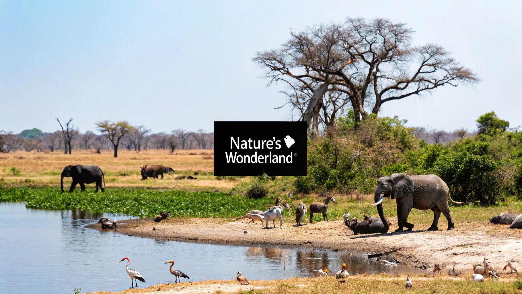
The Delta's waterways act as natural corridors for predators, particularly during certain seasons. As floodwaters recede, they create temporary feeding grounds that attract large herds of herbivores. These areas become hotspots for predator activity, offering incredible viewing opportunities. Certain islands also serve as vital refuges during high water, providing sanctuary for a variety of species. An Okavango Delta map can help you anticipate these natural gatherings and appreciate the intricate dance of life within this unique ecosystem.
Mapping Techniques and Ecological Zones
Modern mapping techniques, including thermal imaging, add another dimension to traditional cartography. Thermal imaging reveals subtle temperature differences, indicating areas of animal activity and providing a real-time glimpse into the Delta's dynamic ecosystem. Experienced wildlife researchers often emphasize the importance of studying land contours, vegetation types, and water channels to accurately interpret these patterns. Every detail on the map becomes a clue to understanding the complex ecological relationships at play.
The Okavango Delta is a vital ecological region, encompassing permanent swamps of approximately 600,000 hectares and up to 1.2 million hectares of seasonally flooded grasslands. Its importance is underscored by its designation as a reserve in 1965 and a Ramsar Site in 1996. This protected status supports a rich diversity of species, including endangered cheetahs and African elephants. For more detailed statistics, explore this topic further.
Wildlife Viewing Guide by Region
The table below provides a quick overview of key wildlife concentrations across different areas of the Okavango Delta, offering insights into the best viewing seasons and accessibility levels for each region.
Wildlife Viewing Guide by Region: Key species concentrations across different areas of the Okavango Delta
| Region | Dominant Species | Best Viewing Season | Accessibility Level | Notable Features |
|---|---|---|---|---|
| Central Delta | Elephants, Lions | Mid-Flood Season | Moderate | Wide water channels, seasonal refuges |
| Northern Islands | Leopards, Sitatunga Antelope | Early Rise of Floods | Challenging | Elevated terrain, predator corridors |
This table highlights the diverse wildlife viewing opportunities available throughout the Okavango Delta. From the readily accessible Central Delta to the more remote Northern Islands, each region offers unique encounters with fascinating species.
For those eager to enhance their map-reading skills, How to Master Wildlife Mapping Techniques offers valuable insights. Mastering these techniques not only enriches your safari experience but also unveils nature's hidden treasures on every journey.
Turning your Okavango Delta map knowledge into a truly memorable safari starts with a well-thought-out plan. By using expert strategies, you can craft an experience perfectly suited to your individual interests. Whether you’re a passionate photographer hoping for that perfect shot or a nature lover wanting to fully experience the Delta’s diverse ecosystems, planning is key.
Choosing the Right Map for Your Adventure
Just as every safari is unique, so too are Okavango Delta maps. Different maps provide different levels of detail. Some highlight geographical features, while others focus on wildlife locations or the seasonal flooding. Think about your safari style when you choose a map. For a self-drive adventure, a detailed topographical map with clear road markings is crucial. If wildlife photography is your focus, a map showing known animal corridors and seasonal floodplains will be indispensable.
Decoding Camp Locations: More Than Just a Dot on the Map
Camp locations on your Okavango Delta map signify more than just a place to sleep. They represent key access points to specific wildlife viewing areas, water activities, and unique experiences. A camp near a permanent water source might offer year-round mokoro trips and excellent birdwatching. A more remote camp, accessible only during certain seasons, might provide incredible access to migrating herds or predator hotspots. Understanding these nuances helps you choose the ideal camp for your dream safari.
The Critical Link Between Map Position and Safari Quality
It's easy to assume a centrally located camp offers the best experience. But in the Okavango Delta, a remote location can often mean better wildlife viewing. Some seemingly isolated camps are strategically positioned near natural wildlife corridors or seasonal floodplains. These locations might offer a higher chance of seeing dramatic predator-prey interactions or large groups of animals gathered at limited water sources. Learn more in our article about Tour sitemaps. Identifying these prime viewing areas on your map is crucial for a rewarding safari.
Mastering Travel Time Estimation and Seasonal Accessibility
Estimating travel time in the Delta involves more than simply measuring distances on a map. The constantly changing water levels significantly impact accessibility and routes. A trip that takes a few hours in the dry season could easily become a full day during peak flooding. Understanding the seasonal variations and potential access challenges is essential for a realistic itinerary. You might be interested in: How to master safari planning. This involves researching seasonal flood patterns, talking to experienced guides, and using current information on channel navigability. By considering these factors, you’ll avoid disappointment and maximize your exploration time in this amazing wilderness.
Protected Zones: Navigating Conservation Boundaries
An Okavango Delta map reveals more than just waterways and islands. It showcases a complex network of protected zones, each crucial for preserving this unique ecosystem. Understanding these boundaries is vital for respecting the environment and maximizing your safari experience. These zones represent decades of conservation work and the delicate balance between wildlife protection and human activity.
Moremi Game Reserve: A Sanctuary Within The Delta
The Moremi Game Reserve, a strictly protected area within the Okavango Delta, offers a prime example of successful conservation. Hunting is prohibited within its boundaries, and strict regulations control tourism. This protection allows wildlife to thrive, making Moremi a haven for diverse species. Identifying Moremi's boundaries on your Okavango Delta map is essential for understanding permitted activities and access points. This helps you plan responsibly and ensures your visit contributes to the reserve's continued success.
Private Concessions And Community-Managed Areas
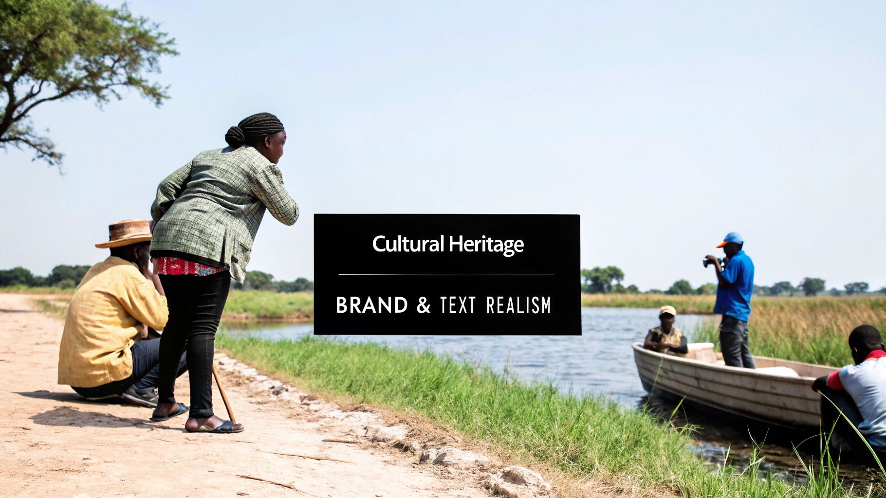
Beyond Moremi, the Okavango Delta map reveals a mix of private concessions and community-managed areas. Private concessions offer a more exclusive safari experience, often with limited visitor numbers and specialized activities like walking safaris or night drives. Community-managed areas demonstrate how tourism can empower local communities and drive conservation. These areas often offer culturally immersive experiences, allowing visitors to engage with local traditions while supporting sustainable livelihoods.
Wildlife Corridors And Critical Breeding Grounds
The designated zones within the Okavango Delta are interconnected by wildlife corridors, vital pathways that allow animals to move freely between different habitats. Recognizing these corridors on your map helps you understand wildlife movement and predict prime viewing locations. For those interested in expert map navigation, consider a Captain Cook Snorkel Tour to enhance your appreciation of natural landscapes. Some areas are designated as critical breeding grounds, requiring special protection during specific seasons. These areas might have restricted access to minimize disturbance during sensitive periods, ensuring the long-term health of wildlife populations.
The Okavango Delta map reflects ongoing conservation efforts and adaptive management strategies. For example, some areas are designated for rhino reintroduction programs, vital initiatives to restore endangered populations. For accommodation options within these protected zones, you can learn more here. Community conservancies showcase the partnership between local communities and conservation organizations. By involving local people in managing and benefiting from tourism, these initiatives promote sustainable development and long-term wildlife protection. Understanding these successes enhances your appreciation of the Delta's conservation efforts.
Plan Your Okavango Delta Adventure Today
Ready to experience the magic of the Okavango Delta? Let Maximum Adventure Trails be your guide. We offer expert-curated safaris that respect conservation boundaries and maximize your wildlife encounters. Explore our website to discover the perfect adventure tailored to your interests and create unforgettable memories in this remarkable wilderness. Book your Okavango Delta safari with Maximum Adventure Trails!