

- 8 Views
- 12 Min Read
- (0) Comment
Chobe is big, about 4,500 square miles, and the roads inside it are not all the same. Pick the wrong entrance or the wrong track and you can lose half a day, or get stuck in deep sand. A good Chobe National Park map shows you where to start, where the wildlife is, and which routes you can actually drive.
Here is the short answer. The park splits into four main areas: Chobe Riverfront, Savuti, Linyanti, and the Nogatsaa grasslands. The riverfront is the most visited and the easiest to reach, with its main gate near Kasane. Savuti and Linyanti sit farther west and south, and they need a high-clearance 4×4 in most seasons. If you are looking for a map of Chobe National Park Botswana to plan a self-drive, those two facts decide your route.
Below, we walk through each region, the main gates, where lodges and campsites sit, and which roads are open in the wet and dry seasons. Our guides at Maximum Adventure Trails drive these tracks year-round, so the notes come from the field, not from a brochure.
Why a Chobe National Park map matters for your trip
Most visitors treat a map as a way to find the gate. In Chobe it does far more. The park has no perimeter fences, few road signs, and cell coverage that fades fast once you leave Kasane. A map of Chobe National Park is your main planning tool at home and your backup navigation once you are inside.
Distances look short and drive long
Straight lines lie in Chobe. A stretch that looks like a quick hop on paper can take hours on deep sand tracks, and the same road can feel different in March than in September. Use the map to read the real driving distance, then add time for the surface.
| From Kasane to | Approx. distance | Typical drive time |
|---|---|---|
| Sedudu Gate (Riverfront) | 3 mi (5 km) | 10 minutes |
| Ngoma Gate | 35 mi (55 km) | About 1 hour |
| Savuti | 105 mi (170 km) | 5 to 7 hours in the dry season, longer when wet |
These are our field estimates. Sand, traffic, and elephants on the road all change them. The pattern is what counts: the riverfront is minutes away, while Savuti is a full travel day.
Roads, rules, and risk
Rules matter as much as distance. Driving off the marked tracks is not allowed, and rangers do fine people who cut across the bush for a better photo. A Chobe National Park self-drive map that shows official tracks keeps you legal, and it also keeps you out of soft ground where vehicles bog down.
The bigger point is matching your plan to your vehicle and the season. A sedan or a standard SUV can handle the riverfront loops. It cannot handle the sandy road to Savuti, and the map tells you that before you commit.
A map won’t make the sand any shallower, but it tells you where the sand starts before you are stuck in it.
Wildlife changes the picture too. Chobe holds tens of thousands of elephants, plus lions, buffalo, and hippos near the water. Knowing where tracks run close to the river or a waterhole helps you plan safe stopping points and avoid driving at dusk in open, remote country.
What a useful map should show
Not every map is worth printing. Before you rely on one, check that it includes the details below.
- Official gates, including Sedudu, Ngoma, Mababe, and Savuti
- Track surface notes, such as tar, gravel, or deep sand
- Fuel stops, since there is none inside the park
- Campsites and lodges, marked by area
- Riverfront loops and waterholes for game viewing
- Seasonal closures, especially around the Savuti Marsh in the wet months
Finally, treat the map as a two-copy system. Carry a paper version, and download an offline map in Google Maps before you leave Kasane. If your phone loses signal at a junction, the paper copy still works. Our guides carry both on every trip, and you should too.
How to read the Chobe map: location and main regions
Start at Kasane
Orient yourself first. On a map of Chobe National Park Botswana, find the far northeast corner of the country. Kasane sits there on the Chobe River, which forms the border with Namibia, and Victoria Falls is about 50 miles (80 km) east. Kasane is your anchor point, and every other distance reads more easily once you measure from it.
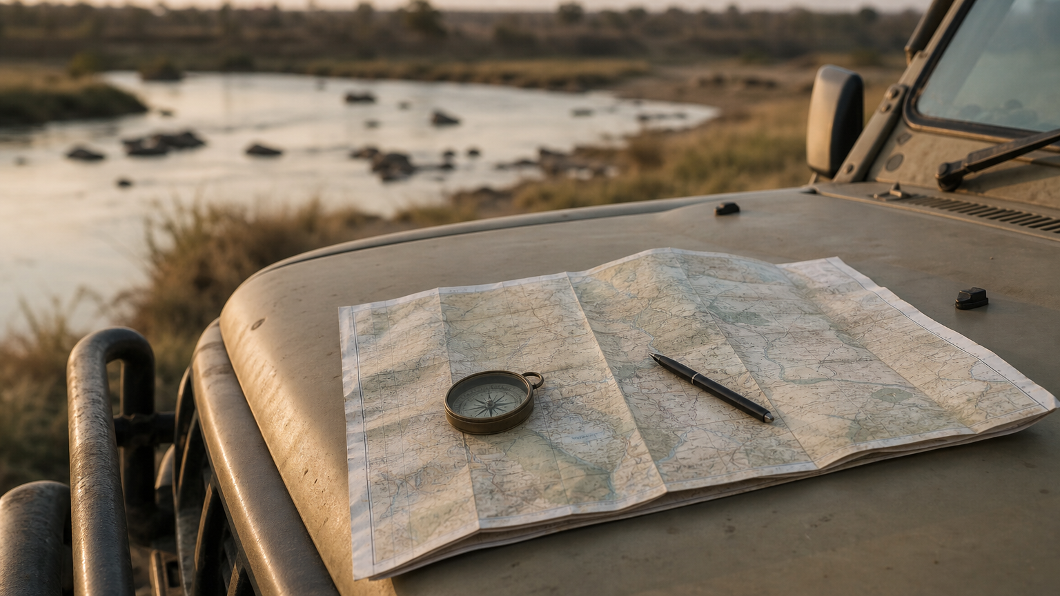
From the river, the park runs south and west across roughly 4,500 square miles (11,700 sq km). Roads thin out quickly as you leave the water. Fewer roads means fewer services, so the farther you go from Kasane, the more you must carry yourself.
The four regions at a glance
A good Chobe National Park Botswana map colors or labels four zones. They look similar on paper but drive very differently.
| Region | Where it sits | Known for | Vehicle advice |
|---|---|---|---|
| Chobe Riverfront | North edge, along the river by Kasane | Huge elephant herds, hippos, buffalo, boat cruises | Standard vehicle in the dry season, 4×4 when wet |
| Nogatsaa | Inland, south of the riverfront | Pans, sable and roan antelope | 4×4 |
| Savuti | Southwest | Savuti Channel and Marsh, lions, hyenas | High-clearance 4×4 |
| Linyanti | Northwest, on the Linyanti River | Remote riverside camps, elephants, hippos | High-clearance 4×4 |
Most first-time visitors only need the riverfront, and that is a fine choice. Two days there gets you game drives and a river cruise without a single sandy track. Add Savuti only if you have at least three more days and a capable vehicle.
Pick your region by vehicle and days available, not by the photos you have seen.
When you study any map of Chobe National Park, check the scale before you decide. The riverfront looks small beside Savuti, yet it holds the densest wildlife and the most visitors. Linyanti is the quietest zone, which is why safari operators and private camps favor it.
How to use the map for gates, airports, and getting there
Gates and airports set the timing for your whole trip, so find them on the map before you book anything else.
Match the gate to your plan
Gates shape your day. On a map of Chobe National Park, mark every entrance and note which region it serves. Then check opening hours, because gates close around dusk and you must be out of the park or at your campsite by then.
- Sedudu Gate: the riverfront entrance, about 10 minutes from Kasane
- Ngoma Gate: the western end of the park, about 1 hour from Kasane
- Mababe Gate: the southern entrance, used mostly by travelers coming from Maun
- Savuti Gate: the entrance for the Savuti area in the southwest
Fill your tank in Kasane before you reach any of them. There is no fuel inside the park, and the map will not show a pump that does not exist.
Choose your airport and border route
Most visitors fly into one of three airports. The closest is Kasane, but Victoria Falls airport and Livingstone often have more flight options. Each one involves a different drive.
| Airport | Country | Approx. distance to Kasane | Notes |
|---|---|---|---|
| Kasane International | Botswana | 3 mi (5 km) | About 10 to 15 minutes, no border crossing |
| Victoria Falls | Zimbabwe | 60 mi (100 km) | About 1.5 to 2 hours with the border |
| Livingstone | Zambia | 50 mi (80 km) | About 1 to 1.5 hours with the border |
These are field estimates. Border queues vary by day, so add at least an hour of buffer if you have a boat cruise or game drive booked the same afternoon.
Plan from the border, not the airport: the Kazungula crossing is where most arrival days are won or lost.
You can also skip the driving. A private cross-border transfer from Victoria Falls or Livingstone handles the paperwork queue and gets you to Kasane without a rental car.
How to plan a Chobe self-drive route using the map
Self-driving Chobe works best when you plan in layers. Start with roads you know your vehicle can handle, then add stretches only if time and ground clearance allow. A Chobe National Park self drive map makes those layers easy to see, and it helps you avoid overcommitting on day one.
Build the route in four steps
Keep the map open and a pen in hand. Work through the steps in this order, and you will catch most problems before you leave Kasane.
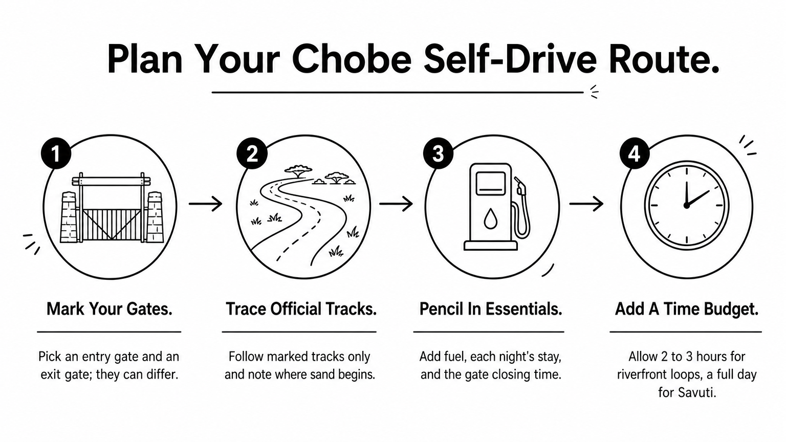
- Mark your entry gate and your exit gate. They do not have to match.
- Trace only the official tracks between them, and note where the surface changes to sand.
- Pencil in fuel in Kasane, your campsite or lodge each night, and the gate closing time.
- Add a time budget. Allow 2 to 3 hours for a riverfront loop and a full day for Savuti.
Match the route to your vehicle
Riverfront loops are the easy win. From Sedudu Gate, the river road runs about 12 miles (20 km) west toward Ihaha, with water views and constant elephant sightings. In the dry season a standard vehicle can manage it, though a 4×4 is safer after rain.
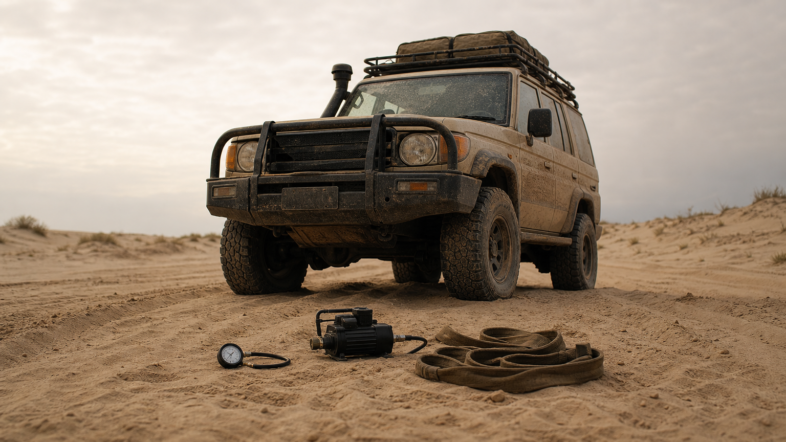
Deeper routes call for more preparation. Savuti and Linyanti tracks have long stretches of loose sand, so you need high clearance, a tire pressure gauge, a compressor, and recovery gear. Drive in two vehicles if you can. A single vehicle stuck in sand, far from signal and with elephants nearby, is a serious problem.
Plan the route you can recover from, not the one that looks best on paper.
Finally, book campsites and park permits before you arrive, since sites on the map fill up in the dry months. If this level of detail sounds like a lot, a guided drive over the same tracks is a sensible alternative. You still see the park, and someone else carries the recovery kit.
How to choose where to stay using the map
Where you sleep decides how much driving you do each day, so plot your beds before your routes. On a map Chobe National Park travelers use for planning, lodges and campsites cluster in three zones, and each zone suits a different kind of trip.
Three stay zones on the map
| Zone | Stay options | Best for |
|---|---|---|
| Kasane and the riverfront edge | Hotels and lodges outside Sedudu Gate | First-timers, short stays, boat cruises |
| Inside the riverfront | Chobe Game Lodge, Ihaha campsite | Early starts, quiet evenings by the river |
| Savuti and Linyanti | Public campsites, private tented camps | Remote safaris, self-sufficient campers |
Kasane works for most people. You are about 10 minutes from the gate, you have fuel, groceries, and restaurants nearby, and you can leave the park before dusk without stress. Sleeping inside costs more or means camping in Chobe, but you start the morning drive ahead of the gate queue, when predators are still active.
Read the map for distance to the action
Measure from your bed to the first game drive, not to the park boundary. A lodge that looks close can sit behind a sandy track or across the river in Namibia. Check the surface between your room and the gate, and remember that Savuti and Linyanti camps are a full travel day away from Kasane.
The best bed on the map is the one you can reach before the gate closes and the light fades.
Run each option through this short checklist before you book.
- Distance to the nearest gate and its closing time
- Road surface between the lodge and the park
- Whether meals, fuel, and drinking water are included or nearby
- Lead time in the dry season, roughly May to October, when public campsites and small camps fill first
If that list feels like homework, hand it off. We book lodges and campsites alongside tours, so your accommodation matches your route and your vehicle. Either way, mark your chosen stay on the map now. The itineraries below build on it.
Sample Chobe itineraries built around the map
Itineraries turn a map into a plan. Each one below uses the gates, regions, and stay zones from the earlier sections, so keep your Chobe National Park map open and trace along. Times are field estimates, and every route assumes you are out before the gate closes.
Two days: the riverfront
This is the right first trip for most people, and it needs no sandy tracks. A standard vehicle works in the dry season, and you sleep in Kasane with fuel and restaurants close by.
- Day 1: Enter at Sedudu Gate for a morning game drive on the river loops. Return to Kasane for lunch, then take a sunset boat cruise.
- Day 2: Drive the river road west toward Ihaha, about 12 miles (20 km), and picnic by the water. Exit before dusk.
Four days: riverfront plus Savuti
Savuti turns a short stay into an expedition. You need a high-clearance 4×4, recovery gear, and a full tank from Kasane, because the drive alone takes 5 to 7 hours in the dry season.
Count travel days as real days, because on Chobe’s sand they are.
- Day 1: Riverfront game drive and boat cruise, then sleep in Kasane.
- Day 2: Leave early and drive to Savuti. Camp or check in.
- Day 3: Spend the whole day on the Savuti Channel and Marsh, where lions and hyenas hunt.
- Day 4: Drive back to Kasane and exit before the gate closes.
Five or more days: Savuti, Linyanti, and out via Mababe
Longer trips reward you with quiet. Add Linyanti for remote riverside camps and far fewer vehicles, then leave through Mababe Gate if you are continuing to Maun. That one-way line saves you from backtracking over the same sand.
Book camps for every night before you leave, since the best sites fill first in the dry months. If you would rather not run the recovery kit yourself, we can build any of these routes as a guided trip, with lodging, fuel stops, and transfers already marked on the map.
Finding your way around Chobe
A good Chobe National Park map comes down to three decisions. Pick your region first, then match your vehicle to the road, and sleep where you can reach the gate before it closes. The riverfront suits most first trips. Savuti and Linyanti reward travelers who have extra days, a high-clearance 4×4, and recovery gear.
Carry a paper copy and an offline download, and fill your tank in Kasane before you enter any gate. Add a buffer for the border, and keep your plans realistic about sand. Do that, and the map does its job from the first gate to the last campsite. If you would rather leave the tracks, bookings, and transfers to people who drive them every week, plan your Chobe safari with Maximum Adventure Trails and let our guides turn this map into a trip.