

- 4 Views
- 8 Min Read
- (0) Comment
Key takeaways
- An Okavango Delta map has three broad zones: the northern panhandle, the permanently wet inner delta, and the seasonal floodplains that include Moremi Game Reserve.
- Safari camps sit inside numbered concessions, and their position on the map decides whether you explore mostly by water, by 4×4, or a blend of both.
- Floodwater arrives from the Angolan highlands months after the rains, so the wettest part of the delta shifts across the year and changes where wildlife gathers.
- Nearly every camp is reached by light aircraft from Maun, then by mokoro or 4×4 for the final leg.
- Pick your region first, then your camp: the map tells you far more about your trip than any single lodge brochure.
An Okavango Delta map makes sense once you see it as three zones stacked from north to south: the narrow panhandle where the river enters Botswana, the permanently wet inner delta in the middle, and the seasonal floodplains that dry out and refill each year. Where a camp sits inside those zones tells you almost everything about your trip, from whether you glide through channels in a dugout canoe to whether you spend mornings tracking lions from a 4×4. This guide walks through the geography, the concessions where the camps sit, how the flood reshapes the map through the year, and how you move between it all.
Reading the Okavango Delta map: panhandle, inner delta, floodplains
The Okavango is unusual because its river never reaches the sea. It spreads out across the flat Kalahari sands and evaporates, forming a vast inland fan. On a map, that fan divides into three parts.
The panhandle is the long, straight corridor in the north where the Okavango River flows in from Namibia's Caprivi and Angola beyond. Water here is deep and permanent year round, and the fishing is famous. Camps in the panhandle lean heavily on boats and birding rather than big-game drives.
The inner delta is the heart of the fan. Channels braid around thousands of palm-dotted islands, and the largest, Chief's Island, anchors the region. This is classic water country. Camps here are often true island camps reached only by boat or plane, and the mokoro is the signature way to explore.
The seasonal floodplains ring the southern and eastern edges. These areas flood and recede each year, so the ground alternates between grassland and shallow lagoon. The public Moremi Game Reserve sits on this eastern side and offers the delta's best-known mix of land and water. If you are still deciding whether the delta belongs on your itinerary at all, the Okavango Delta Safari first-timer's guide is a good companion to this map.
The delta earned global recognition when it became the 1,000th UNESCO World Heritage Site, inscribed on 22 June 2014, according to UNESCO's own announcement. That milestone is a useful shorthand for just how significant this wetland is on any world map, not only a Botswana one.
Where the top safari camps sit on the map
Outside Moremi, the delta is carved into numbered concessions, wildlife management areas usually labeled with an "NG" prefix on detailed maps. Each concession is leased to a single operator or small group of camps, which is why the delta feels so private. You rarely see another vehicle that is not from your own camp.
This concession system is the single most important thing to understand when matching a camp to a map location:
- Eastern concessions near Moremi give the widest range of activities, with reliable game drives plus water when the flood is in. These suit travelers who want the Big Five alongside a canoe trip.
- Central inner-delta concessions are water-first. Expect mokoro, motorboat cruises, and walks on islands, with limited or no driving in high-water months.
- Northern and panhandle concessions favor boating, fishing, and birding over classic predator viewing.
A camp's dot on the map, in other words, is really a promise about your daily routine. Two lodges that look similar in photos can offer completely different experiences because one sits on a permanently flooded island and the other on a floodplain that dries to savanna. When you plan a wider trip, it helps to see how the delta connects to Botswana's other headline region, which the combined Chobe and Okavango safari guide lays out clearly.
How seasonal flooding shifts wildlife and access routes
The most counterintuitive part of any Okavango Delta map is that the wet areas move. Botswana's rains fall roughly from November to March, but the flood you see in the delta comes mostly from Angola's highlands far to the north. That water travels a long, slow route south and takes months to arrive, so the delta typically reaches its peak spread around the middle of the year, well after local rain has stopped.
For your map, this means a few practical things:
- The panhandle floods first, since it is closest to the incoming river, then the pulse pushes down into the inner delta and finally the southern floodplains.
- Wildlife concentrates around water as the surrounding Kalahari dries out, so game viewing in and near permanent channels sharpens through the dry winter months.
- Access routes change. Some camps that reach guests by 4×4 in the low-water season switch to boat or mokoro transfers once the flood arrives, and a few roads simply close.
Because the flood is late and gradual, the calendar month you travel matters as much as the region you choose. Locking your dates first keeps the whole plan coherent.
Getting around: mokoro, 4×4 and light-aircraft transfers
Movement in the delta happens in three layers, and a map helps you picture how they connect.
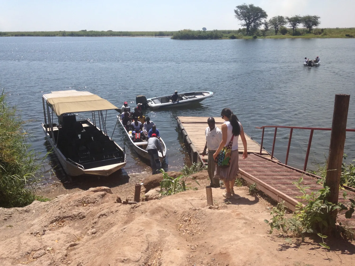
Light aircraft are the backbone. Maun is the main gateway town, and small planes fan out from its airport to dozens of bush airstrips scattered across the concessions. Most delta itineraries begin with a scenic flight over the channels, which doubles as the best way to appreciate the fan from above. Kasane, near Chobe, serves as a secondary gateway if you are combining regions.
The mokoro is the traditional dugout canoe, poled from the back through shallow, lily-covered channels. It is quiet, slow, and close to the water, ideal for frogs, birds, and the small details you miss from a vehicle. Mokoro trips depend on water depth, so they are most reliable in the wetter central and southern delta during flood season.
The 4×4 covers everything on land. Game drives in Moremi and the drier concessions rely on vehicles, and in low-water months some camps use 4×4 transfers from the airstrip to the lodge. Where water and land meet, camps often mix all three modes in a single stay.
The rule of thumb: the more water around a camp, the more your days revolve around boats and mokoro; the drier the setting, the more you drive.
Using the map to pick the right delta region for your trip
Start with the region, not the lodge. Once you know which zone suits you, the shortlist of camps narrows itself.
- Want the classic land-and-water blend and strong predator sightings? Look at the eastern side around Moremi and its neighboring concessions.
- Want the purest water experience with mokoro and island calm? Aim for the central inner delta.
- Want fishing, boating, and birding over big-cat drives? The panhandle and far north fit best.
- Traveling in the low-water months? Favor concessions with reliable year-round channels or plan a stronger 4×4 focus.
Reading the map this way also protects your budget, because a water-first camp in a dry month, or a drive-focused camp when roads are flooded, can leave you paying for activities the season does not support. This is where local knowledge earns its keep. Maximum Adventure Trails builds delta itineraries around exactly these seasonal shifts, matching your travel dates to the concessions and transfer types that will actually be running when you arrive, so the map on paper matches the trip you experience.
Your concrete next step: settle your travel month first, then send those dates to the Maximum Adventure Trails team and ask which delta region will be at its best that week. With the season fixed, choosing the right concession, camp, and mix of mokoro, 4×4, and flights becomes straightforward.
Frequently asked questions
What are the main regions on an Okavango Delta map?
The three main regions are the panhandle in the north, the permanently flooded inner delta at the center, and the seasonal floodplains to the south and east, which include the public Moremi Game Reserve.
How do you actually get around the Okavango Delta?
Most travelers fly by light aircraft from Maun to a bush airstrip, then transfer to camp by mokoro, motorboat, or 4×4 depending on how much water surrounds the camp that season.
When does the Okavango Delta flood?
Floodwaters from Angola's summer rains take months to travel south, so the delta is usually at its fullest around the middle of the year, well after Botswana's own rainy season has ended.
Is the whole delta open to the public?
No. Moremi Game Reserve is the main publicly accessible protected area. Most of the surrounding delta is divided into private concessions where access is limited to guests of the camps operating there.
Which delta region is best for a first safari?
A camp on the eastern side near Moremi gives you a mix of land and water activities, which suits first-time visitors who want big-game drives as well as a mokoro trip.